The next area we are heading for is called the DelMarVa peninsula (Delaware, Maryland, Virginia) and the Chesapeake Bay. Only problem is we got delayed in Norfolk/Portsmouth for a week due to bad weather! Arrived Monday afternoon, changed oil and did chores on Tuesday, putzed around Wednesday doing some sight seeing and waiting for a package to be delivered and planned on heading out Thursday morning. Woke up to a lousy forecast of rain and wind and decided to be wimps and stay another day. Then strong North winds and 3-5 waves predicted for Friday and Saturday. Damn!
But we did try to take advantage of the time and do some sightseeing. There is a small passenger ferry that runs between Portsmouth and Norfolk across the bay on a regular basis. A short walk from the marina and a quick (10 minute) ride and you are in downtown Norfolk.
Norfolk is a major Navy port and we passed these two large warships in dry dock on the ferry ride.
We toured this very large tall ship berthed on the waterfront, "Cuauhetemoc" from Mexico. It is 90.5 meters long (270'), displaces 1,800 tons, and has a crew of 186. It was leaving the next day for Dublin, Ireland. It was scheduled to travel through the Mediterranean and then back through the Panama Canal to the west coast of Mexico.
While we were there a group of visiting officers from another ship arrived; lots of gold braid!
And of course in the middle of it all, another cruise ship did a 180 degree turn at the stern of the ship.
The downtown parks are really neat, with plush sofas and chairs, tables with umbrellas and lots of grass and shrubbery.
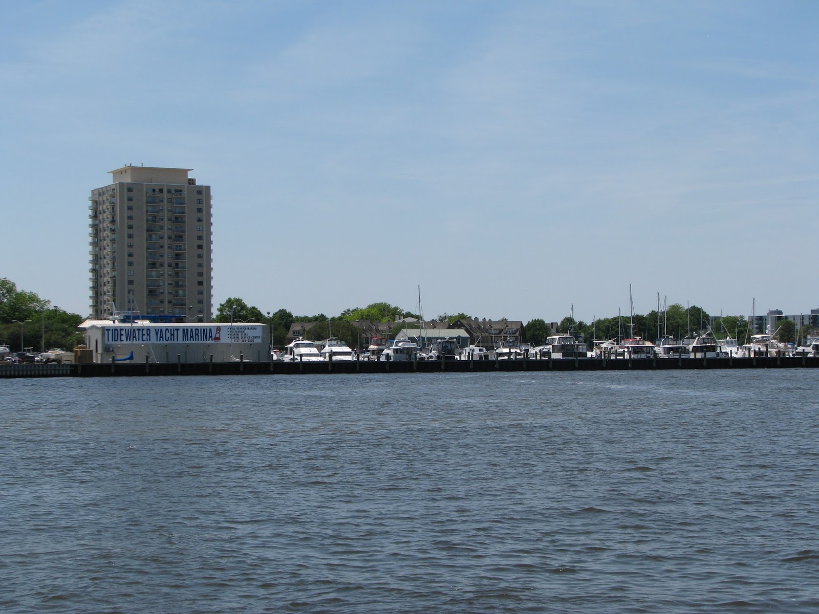
And on the ferry ride back we had a good view of the Tidewater Marina; we almost grew roots there!
On May 24th we managed to free ourselves from the dock at 6:00 AM and head out the long channel past all the Navy Ships, headed for the Chesapeake. We heard a "securite" call on the VHF (this is usually a notification for nearby vessels) that a tug had a 'dead ferry' in tow.
This is a disabled Staten Island Ferry from New York City that is being towed in for repairs somewhere in the Norfolk area; there are numerous facilities to choose from.
The Chesapeake is an enormous body of water: it stretches over 200 miles long and goes from 30 miles wide down to just 2.8 miles at it narrowest. There are over 150 major rivers and streams that flow into the Chesapeake, many with original native names such as the Potomac, Paxutent, Rappahanock, and Poquoson.
We were headed for Deltaville, a small town on the Virginia side. As you go up the wide bay you see these enormous lighthouses, fifty plus feet tall, miles from shore. This one is called the "Wolf Trap".
The morning started off great with the current in our favor but the winds gradually increasing to 17 with gusts to 21. So things started getting rolly and uncomfortable; this is not a sailboat with sails to help steady you! Reached Deltaville around 1:30 and got in the dinghy to see the town. As we were tying up to the town dock (not very good) a gentleman nearby called to us from his porch and told us to tie up at his dock.
So we met Virgil Miller, quite the character. As we started walking towards town, Virgil drove up, told us to get in his car and we spent the next hour or so on a personal tour of the town. Virgil married Mable when he was 18 (he's now 87) and they spent most of their life here in Deltaville. And it turned out Virgil spent most of his time running a successful boat-building company and buying up anything he could get his hands on. We got to see Miller's Marina, Miller's Boat Building, Cocomo's Restaurant, floating cottages for rent, acres of woodland, you name it. They live on Lover's Lane and Virgil said that the lovers got better as you went further up the road; he lives at the end! And of course I forgot the damn camera!
Off the next morning at sunrise headed for Solomons, MD, a 'boating mecca'.
Passed lots of crabber's hauling traps on the Bay in the shallow waters.
And more lighthouses.
We anchored in the creek at Solomons. Nice little town with lots of restaurants, a fantastic marine museum and of course my favorites: a liquor store and a West Marine (this time in the same building, could you ask for more?).
Across the creek was this neat boat house, a sliding garage door to protect the boat on davits and a little apartment above. I've included this especially for my buddy Otto - perhaps he will build one of these someday!
This a shot of the museum and the Drum Point Lighthouse which had been moved and placed on the museum grounds. It was originally located about 150 yards offshore near the entrance to Solomons and the last light keeper raised five children in this house; it was pretty neat and cozy inside but it would have been tight for that many people. You can't just tell the kids to outside and play!
Left Solomons at 5:45 headed to St. Michael's MD on the other side of the Bay. We had planned on going to Annapolis but changed our minds as the water and winds were so pleasant (hard to believe!).
St, Michael's is an historic town (founded in the mid 1600's) with quaint little brick/cobblestone sidewalks and streets. A bit touristy now but still nice. And of course it has it's own maritime museum.
Quaint historic homes.
With classic sailing boats for tours.
And some not so classic ones.
We had dinner at the Crab Claw restaurant (soft shell crabs - these are crabs that have 'molted' their shells and you can eat the whole thing, usually whole and deep fried, yummy!) while a thunderstorm rolled through. Gave us a nice rainbow.
Hauled anchor at 5:45 for the 19 mile run back to the middle of the Bay headed for Annapolis. West Marine is supposed to have four new chart kits (large books with maps and guides) for the Hudson River and the Great Lakes. So we worked our way up a small creek lined with marinas until we found a tight anchoring spot. Our guidebook said West Marine was a short dinghy ride away; not exactly. Eventually we talked to some fellows working on a boat at the marina and got directions. It required another dinghy ride and then a bike ride to get there. And of course they only had three of the four charts that I ordered. Figures.
Back to the Bay and headed north towards the C&D Canal which links the Chesapeake to the Delaware Bay.
Passed this working lighthouse which is almost identical to the one at the museum.
The shores of the bay are lined with beautiful houses on large acreages and farms that go right down to the water's edge. You can see why it was settled so early and extensively; very nice country. The east side of the bay is much more rural while the west side is more industrialized and not as scenic.
Stopped at an anchorage called Worton Creek on the east side of the bay; it's getting narrower now - you can easily see the other side. Thunderstorms were brewing and we saw this blimp (a weather blimp?) being hauled down to it's base - it is the same as the one we saw two weeks ago in Elizabeth City.
The thunderstorms stayed south of us and gave us this spectacular sunset.
We were both tired from the last few days and decided to sleep in a bit and did not haul the anchor until 7:30. Our friends, Kathie and Werner, were ahead of us by 15 miles or so and they emailed that the weather forecast for the following day was not good and instead of staying in the C&D canal they were going to head for Cape May. When we left we had north winds and waves against us making for a slow ride to the head of the bay and the start of the C&D canal.
On the way up we passed this little lighthouse perched on a cliff.
Entered the canal and of course were faced with a large barge coming right at us. Quick, move over!
Long boring ride through the canal and fought the current the whole way. Figures! Passed under this railroad bridge and then out into the Delaware Bay. For those of you who have driven the I-95 we entered just south of the Delaware Memorial Bridge where the NJ Turnpike ends (or starts, depending on your perspective).
The Delaware is not nearly as big as the Chesapeake and unfortunately offers very few places to anchor. Based on our late start and unfavorable currents there was no way we were going to make it to Cape May, even though we were doing 10 mph or more with the current.
Valerie found an anchorage about 35 miles from Cape May. Narrow entrance to a winding creek very reminiscent of Georgia complete with horse flies and a wicked current!
Valerie even tried her hand at crabbing (you lower a weighted bait over the side and hope a crab decides to hang onto it) but the current was too strong.
At 5:00 in the morning we were literally rolled out of the bed by a passing crabbing boat going full bore out the creek. That was truly a rude awakening! Up and at 'em! It was a bit unpleasant going at first as we headed south down Delaware Bay, but then things settled down and we had a reasonable run to the entrance of the Cape May Canal. Had to circle around as a car ferry arrived at the same time we did. We took this ferry quite some time ago on one of our many treks from Nova Scotia to Florida; it takes you to Lewes, DL. Here it is docked and unloading.
And voila, welcome to New Jersey! Cape May is the very southern point in New Jersey, and mile zero of the Garden State Parkway.
We had called ahead and reserved a slip at a marina in Cape May. We need fuel, groceries, laundry and a break. Plus the weather is not forecast to be good for the next few days.
So that's the end of that section of the trip. Next up is the New Jersey coast to NYC. Apparently the inside NJICW is very shallow and hurricane Sandy has messed it up, yet the offshore route only has three safe entrances to get inside. We shall see.