Friday, December 18, 2015

FL West Coast - Closing the Loop

We got back to our house in Venice and Valerie went to see the doctor a few days before our departure to Nova Scotia. It turns out she had salmonella poisoning, presumably from the oyster hoagie, and it had basically spread through her body. Time for some heavy duty antibiotics!

The weather up there was great, got all of our chores done, and I got to play with some of my "toys"!


Valerie had to make a second trip to the doctor for another, even stronger, dose of antibiotics to finally clear herself of the salmonella poisoning. Nasty stuff.

Back to Florida and then a 5.5 hour drive to St. Marks to continue the 'loop'.  St. Marks is a very small town but has some interesting history: one of the earliest Spanish explorers, Navarez, built the first 'ships' of the new world from horsehide and local trees to escape the hostile Apalachee Indians in 1528. Then in 1538, De Soto's men found the remains of the forge where Navarez melted armor for tools. Several centuries later, the town was basically flattened by Hurricane Kate in 1985. All this within a five block range!

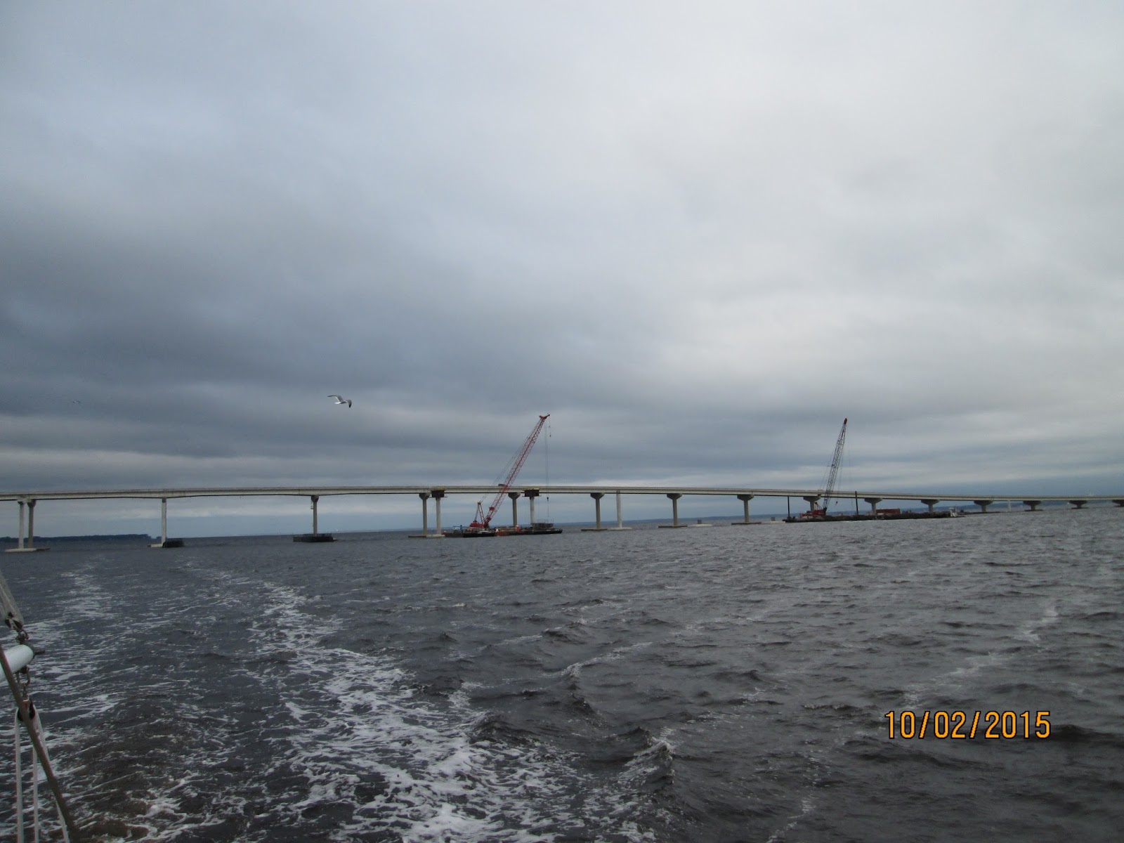
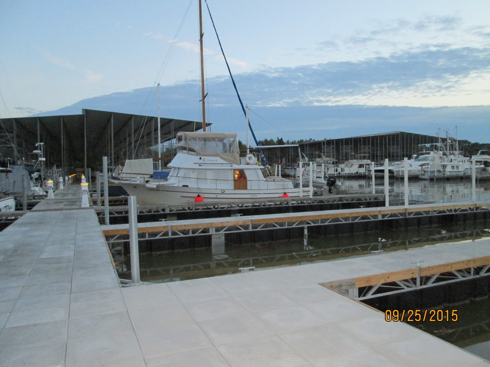
The boat was in great shape after being there for 50 days and we have an excellent weather forecast for the next few days.Up before dawn on November 29th and headed out the river in slight fog. Another looper boat, "Lydia", a 25 Ranger Tug, following us. Couldn't ask for better conditions!


Just perfect! Easy run to Steinhatchee to the "Sea Hag Marina" for a slip for the night - no good anchorages in town.


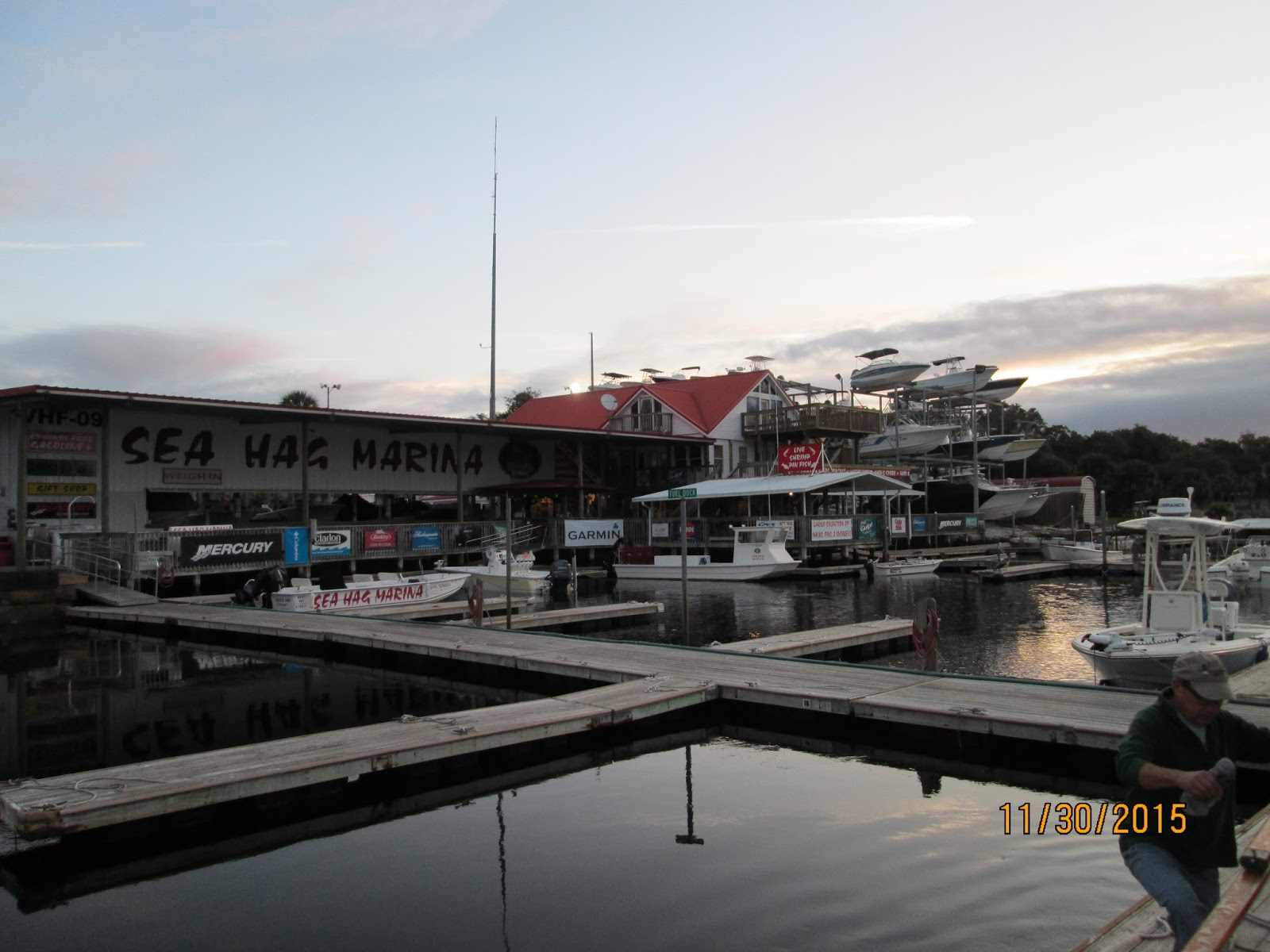
The marina was pretty basic but 'in season' the place must be jumping. They have 28 cottages which they rent out and an equal number of small fishing boats. There is no restaurant but the bar has enough stools to sit at least 100 patrons. Guess we'll have to come back because the place was almost deserted at this time of year.

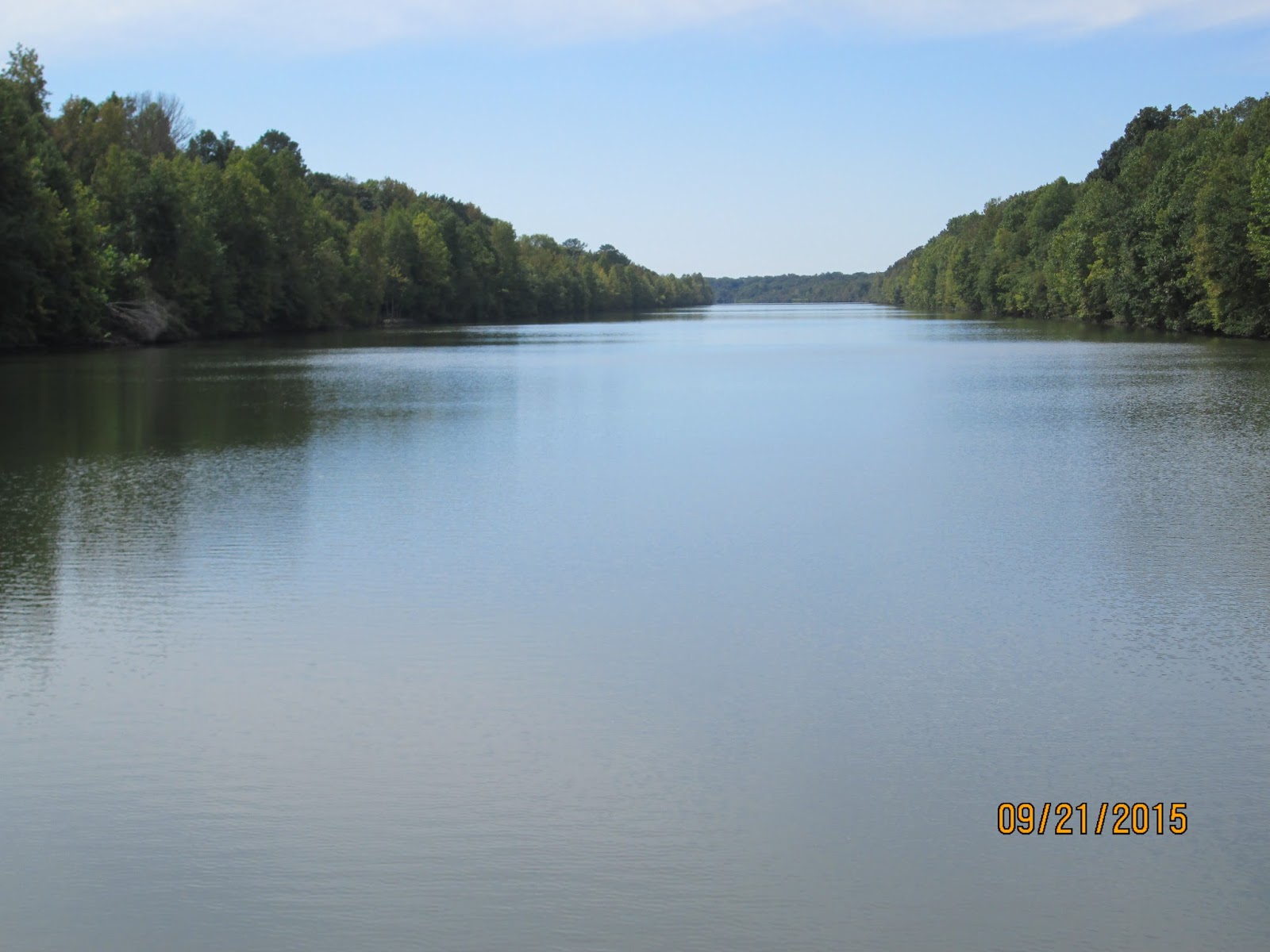
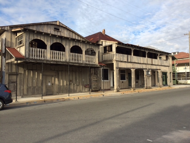
Left the next morning for Cedar Keys. a "quaint" artsy-folksy village accessible by a long, long road from the mainland. We had another perfect day of motoring in essentially flat seas. We can just barely see land, probably 8-10 miles off shore, and yet the water depths are only in the teens or less.

We had a welcoming committee of at least 20 dolphins escorting us in the long channel into town. Anchored off the town, no marinas for larger boats, and took the dinghy in for a walk around town. Neat old buildings.


And the requisite skeleton "waiting for the wife" at one of the local shops.


We had a good night there, joined by "Lydia" who had tried to stay at the boat ramp launch dock but gave it up in the middle of the night. No real protection from winds or waves but the weather cooperated, although somewhat restless as the current fought the breeze but no problems.


Left the next morning for our final leg around the Gulf to get back into the sheltered waters of the ICW at Tarpon Springs. A long, long day (over 80 miles) but great sea conditions. Made it about 10 miles past Tarpon Springs to anchor across from the Dunedin Town Marina. We heard some traffic on the VHF and it turned out our friends on "It's About Time" were making the 180 mile crossing from Apalachicola that night/day with several other boats. One of them, "Fire Bird" lost it's water pump on the way and had to be towed for hours.

Perfect anchorage that night and off at dawn for a trip down the ICW through Clearwater, John's Pass and St. Petersburg Beach - our old stomping grounds from years ago. Crossed Tampa Bay around noon; the Sunshine Skyway Bridge beckoning us southward.


Anchored at the top of Longboat Key, just off Moore's Restaurant, and a short dinghy ride to see our son, Josh; wife, Darcy; and three-year-old grandson Ian!


A nice easy ride the next day down the ICW past Sarasota headed for Venice. There were several bridges that we needed to have open for us and on the radio we heard our old traveling companions. Ron and Bev on "Sea Venture" just behind us; we haven't seen them since Green Turtle Marina in TN.

Drum roll please!!

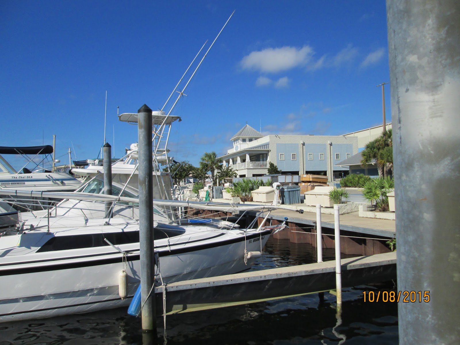
On December 3rd, 2015 at 11:30 AM we officially "crossed our wake" and completed the Great Loop adventure. This is the marina where we started on the morning of April 24, 2015


We have traveled 5,209 miles over the course of 7+ months, spent $5,405 on fuel, and who knows how much on food, booze and marinas! We have made some great friends, saw a lot of the country, survived 109 locks, crossed under countless bridges, learned a lot of history and had no major problems or incidents.

We are now official "Gold Loopers" and can fly the gold America's Great Loop Cruisers Association flag instead of the white one. It's on order now.

Thanks for following along with us on our adventure. We hope you enjoyed it.

Tim & Valerie aboard Chester B

The Panhandle

Once we leave Mobile and cross Mobile Bay we enter the Gulf ICW,  in relatively protected waters until we get to Carrabelle, FL where we will cross the very northern part of the Gulf of Mexico in Florida waters.

We spent several nights at the Dog River Marina, changing engine oil in generator, doing errands, and buying some really fresh shrimp at a local store, "Mud Bugs"! The marina is not too fancy but the folks were very nice. They had a loaner car and the diesel fuel price was pretty good.


There was one other 'looper' boat from Texas there when we arrived but were joined two days later by "Marquesa" and another looper boat that was up for sale at the marina after doing most of the loop. Their broker brought a "low country boil" to the evenings 'docktail' party; shrimp, spicy sausage, and boiled red potatoes! Some good!


We had moved the boat around to the fuel dock late that afternoon, topped up the tanks with diesel, and spent the night at the fuel dock. Off at daybreak for our run down Mobile Bay which has a reputation for being nasty. Not that day, we had a fine ride down to the ICW.

About five miles after entering the ICW we came to "LuLu's" restaurant on the water. LuLu's is owned by Lucy Buffett, Jimmy's sister and we decided to stop for an early lunch - I think this is pretty much a first for us!


We had a great lunch and sat out a heavy downpour while eating - of course we had neglected to close up all the windows and upper enclosure so there was a bit of scrambling to prevent everything getting soaked.

We wound our way up the ICW and finally entered Florida waters after over 5 months of traveling.


We continued on until we reached Ft. McRee and an anchorage behind a large spoil island (created when they dredged out the channels).


Went for a dinghy ride exploring the remains of the fort, had a swim off the beach and were joined by several dolphins - pretty neat.


Off the next morning headed across Pensacola Bay. The day started off fine but windy. We got dive bombed by a large military transport plane headed for the large military (naval) base.


And passed this crazy tower on the beach - we have no idea what it is used for, perhaps a flight control tower but it was a long way from the base.


As we entered Pensacola Bay, the wind really picked up and we had a very lumpy ride ride across and through Santa Rosa Sound. We went off the straight course line and hugged the north shore of Choctawhatchee Bay to get some protection from the north winds and anchored about two-thirds of the way across the bay as close to shore as we dared. Turned out to be an OK anchorage despite the wind howling at night.

Off early the next morning, wind still blowing pretty hard but once we cleared this bridge we got into a canal to West Bay. Got lucky there with the tide pushing us along fast at 10 mph.


In what seemed the middle of nowhere we came across this major ship yard where they were repairing some pretty large boats - one looked like it was meant for servicing the offshore oil rigs.


Made it to the Panama City marina by 12:30 where we got a slip for the night. I biked around town trying to find a West Marine store (which I eventually did) in hopes of buying some better charts of the gulf - no luck.

Off the next morning across East Bay where we traveled with this shrimper boat for several miles.


Saw another shipyard where they we building a freighter in pieces.


And then down a long canal to the Apalachicola River where we took on fuel again at the Apalachicola Marina and spent the night at their docks. Pretty basic facilities (they cater to fueling the shrimp boats) but a short walk into the town of Apalachicola which we really liked. The town, called "Apalach" by the locals was founded in 1831 and was once regarded as the third largest port in the Gulf of Mexico.

We had dinner at the Boss Oyster House - fantastic oysters! This area is sometimes referred to as the 'forgotten coast' of Florida because it is so far off the beaten path. There are more than 700 miles of relatively undeveloped coastal shoreline with four barrier islands. It really is a beautiful area and we'd like to come back and explore by car.

Left the next morning for a lumpy ride (waves hitting us on the beam) but only had to go about 29 miles to get to Carrabelle - the usual jumping-off point for folks headed directly across the gulf to Clearwater, FL near Tampa. Arrived at the early afternoon marina and got assigned a slip that was pretty bad - had to be a gymnast to get off the boat at high tide.

We spent several nights there with two other looper boats, one was "Sea Tiger" which we had first met months ago at the very start of our trip n the Okeechobee waterway. We biked around the small town, and saw some of the local attractions (which were pretty few). This is at the 'bottle house' where they had a lighthouse, a small house and other art all crafted from old bottles.


Carrabelle boasts what is the "world's smallest police station" - apparently this is where the chief operated from years ago. Pretty fancy!


We managed to find some pretty good fresh shrimp and our last day before leaving we had fried oyster hoagies at a restaurant near the marina, "The Fisherman's Wife".

We departed Carrabelle on October the 7th at sunrise, Sea Tiger about an hour behind us. They were headed for Steinhatchee (about 80 miles away), we were hedging our bets and we headed for St. Marks, about 50 miles away. Despite a reasonable weather forecast, the seas were rougher than hoped for although they did settle down in the afternoon.

All day Valerie felt under the weather: chills, queasy, weak and when we anchored at the mouth of the St. Marks River she wasn't doing well. Sea Tiger showed up an hour later saying the seas were too rough and they were headed for Shields Marina, about 6.5 miles up the river; a long, narrow and winding channel. Given the way Valerie was feeling we called the marina and got a slip.


Shields Marina caters mostly to small boaters from Tallahassee but does have a few larger slips. It has a great ship's store, good facilities, great people and there are two restaurants and a small grocery store. And stone crab fishing boats!


We were very surprised when this barge went right past our stern headed out the river. Where the heck did he come from? And am I glad we didn't encounter him on the way in!


Sea Tiger departed the next morning and we told them that we'd be a day behind once Valerie started feeling better. Turns out she spent the next two days in bed with stomach cramps and being sick. Not good at all. Time for a doctor?

So we decided to leave the boat here for several months. We need to get back to Nova Scotia to close up the house there (we had already booked tickets) so we rented a car and headed back to the house in Venice. We'll come back in December and finish the "loop" then.


Tuesday, September 29, 2015

The Tenn-Tom Waterway

The Tenn-Tom (the Tennessee-Tombigbee Waterway) is a man-made canal connecting the Tennessee and Tombigbee Rivers. starting at Yellow River, only a few miles past the Pickwick Lock. It is 234 miles long (is over five times longer and has a total lift 3.5 times greater than the Panama Canal). This mammoth undertaking moved more earth than was moved in the construction of the Panama Canal, and is relatively unknown throughout the U.S. to the general public. Construction began in 1972 and was completed in December, 1984 at a cost of nearly $2 billion. The Tenn-Tom ends at Demopolis, where it joins the Tombigbee River at the southern end. From this point it is 217 miles to Mobile, AL.

Our first anchorage was just a few miles down the waterway behind Goat Island, aptly named. The goats are all male, (big long beards, horns and sporting very large genitalia!) that live on the island. The local boaters come by to feed them.


Off the next morning for our trip down the Tenn-Tom, no real current to speak of and the waterway is narrow and straight.


We've never seen this before, herons sitting on the marker buoys - usually they are feeding along the shoreline.


Our first lock down is a whopper: the Whitten Lock drops us 84 feet (that is as tall as an eight story building)! This is the highest lock we have encountered on the entire trip; in fact this is the third largest lift east of the Mississippi. Locking down seems to be much easier than going up - just drive in, pick a floating bollard about half way in the lock, throw a mid-ship line over the bollard and tie it off. We were the only ones in the lock that morning.


We radio the lock tender that we are secure, he closes the gates and whoosh, down we go at an incredible rate, but very smoothly. The bollard floats down as the water recedes and we just hang on.


The lock just dumped 46 million gallons of water into the Tenn-Tom, just for us!

There is a surprising amount of commercial activity along the waterway. This outfit grinds up trees for mulch and then loads the mulch into barges. Big operation.


Arrived mid-afternoon at Midway Marina, topped off the fuel tanks ($2.99 a gallon!) and then took their loaner car into town, Fulton, for some supplies. We also toured the Jamie Whitten Historic Museum (the lock was named after him, one of the longest serving Representatives in the US House, 53 years).

Off the next morning through more locks. At the first one we got swarmed by Mayflies which were hanging on the lock wall in the shade and decided to go for a ride with us. What a mess!


We are trying to make some time on the waterway and, in reality, there are few marinas or places to anchor. We went through five locks that day and dropped over 130'. We stopped early evening at a creek that wound up toward the town of Columbus and found an anchorage past some smaller boats. The name on this one was pretty cute: "Cirrhosis of the River".


At one of the locks there was a museum and this old boat on display. It is the last steam-powered, paddle-wheel driven "snagboat" in existence. For something like 60 years this boat worked the many waterways, cleaning up snags and logs. Unfortunately, there was no dock to tie up to or we have stopped.


And as we are motoring along what do we see on the bank? A telephone booth! Wonder if it works? The locals seem to have a sense of humor!


Made it to a nice anchorage just below the Heflin Lock in an "oxbow" (a sharp curve) that was fed by the dam. Nice quiet spot and the current kept us straight as an arrow. We were later joined by "Latitude Adjustment", a sailboat (without a mast) that is also headed for Mobile. We had first met them at Midway Marina.


We have had some spectacular sights such as these chalk cliffs which date back to the same time as the White Cliffs of Dover.


And the weather has been almost perfect, cool nights and warm days with just a little wind.


We had been traveling with "Latitude Adjustment" and another fast boat "Good Old Girl" off and on for the past several days and we all ended up at the same marina in Demopolis, the official end of the Tenn-Tom waterway.


We first stopped for some diesel at the fuel dock which services the river tugboats. We took on 62 gallons while the tug opposite us took on 21,000 gallons! Moved over to the marina, Kingfisher, very nice setup. We borrowed their loaner cars and all six of us went out for dinner at one of the local restaurants.

We all left at 7:00 to get through the Demopolis lock together, early morning mist from the dam.


and then "Good Old Girl" took off and left us far behind. We are slightly faster than the sailboat and eventually left them behind as well.

As we go through the locking process it is neat to see the herons and egrets take advantage of the locks. These guys wait until the doors close and then go after the fish that squirt through the gaps in the doors.


We anchored just off the channel in a bight that protected us from the barges, nice peaceful spot except for one barge at 4:30 AM that rolled us back and forth as the wake bounced back and forth between the sides of the channel.


That was one of the longest mileage days we have had in a long time, 91.8 miles and almost 11 hours of motoring. Up at 6:30 and off we go. Past Bobbie's Fish Camp - one of the places some folks think is "must stop" and others think it is a waste of time.


Another long day of motoring down the waterway with perfect weather.


Made 87.6 miles to an anchorage up the Tensaw River, very peaceful. The next morning we started to get into civilization. Coal fired power plants and more barge traffic.


We passed through our last lock and are now at sea level. We have gone through 109 locks on this trip (up & down) and were at our highest point above sea level at Balsam Lake on the Trent-Severn in Ontario, at 841 feet.

Now we are in salt water and welcome to Mobile! It's been a long time since we saw tall buildings, lots of docks with large transport and container ships.


And even naval vessels in dry docks.


We escape the downtown area and get out into the northern section of Mobile Bay with shrimping boats and, good heavens, waves!


A long 15 miles down the shipping lane and into a small channel into Dog River and the marina. We are tired. It started spitting rain as we went in the small channel and was raining buckets by the time we tied up at the dock. We got 8 inches of rain that night. Needless to say, we couldn't see the eclipse with the stormy weather.

We will spend several nights here because the weather forecast is poor and we need a bit of a break from the long days of motoring.