Monday, August 17, 2015

North East Lake Michigan

We left Blind River Marina in the North Channel of Lake Huron on August 5th for a lumpy ride to Drummond Island, MI where we cleared US customs. Off the next morning for an amazing ride across the top of Lake Huron to Mackinac Island. This is the way you want it - dead calm.


Another picturesque lighthouse on the way.


And then into Mackinac Island (pronounced Mackinaw not "ak").


With it's lighthouse and fast ferries loaded with tourists.


There are no motorized vehicles allowed on the island, just horses (600+) and thousands of bicycles. This is a very popular tourist spot with lots of shops, most of them selling fudge - the locals refer to the day tourists as "fudgies".

  
Beautiful homes.


 There is a road that goes completely around the island, we went about half way around, stopped for quick snack at a roadside hotdog stand and were warned about the seagulls.


They didn't get our over-priced dogs! Then up over the top of the island, past the airport for the private jets (I guess you are allowed to land them here, just can't take them downtown), and past the exclusive Wawashkamo golf club - a nine-hole"Scottish links" course for you aficionados. Founded in 1898, it is the oldest one in Michigan.


And past the imposing police department building - size of a small cottage!


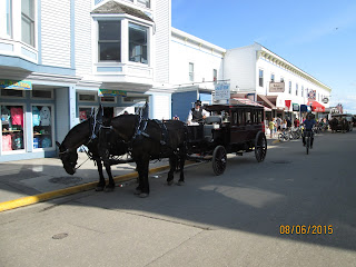
Past lots of horse and buggies/wagons, some even self-drive rentals. It is quite something: you see garbage collection, contractors hauling cement/wood, private buggies, taxis, tour buses, Amazon deliveries, you name it, all horse-drawn.


Over the top of the island and to the Grand Hotel.


They have strict dress-code requirements for dinner: jacket and tie for the men, ladies must not wear slacks. And me without a tie! Darn. The hotel even has it's own horse-drawn carriage that picks folks up at the ferry and takes them to the hotel; very spiffy!


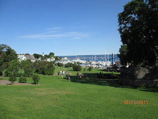
Marina was very nice although a bit rough with all the ferry boats racing in and out and freighter traffic during the night.


Enough of the tourist stuff, we got to keep moving. Departed early the next morning and had a relatively smooth ride under the 4 mile Mackinac Straits bridge.


And into the town of Charlevoix and a slip at the city marina. First we got a 'pump-out' and filled the fuel tanks. Charlevoix is a quaint little tourist town, lots of t-shirt shops and of course the requisite fudge shops; but is also has some nice restaurants.


One thing it is known for are the Earl Young houses. He was an architect in the early 20's who decided he could build unique stone homes that were affordable and unique. He did that! Often referred to a 'mushroom' or 'Hobbit' houses they are really quite something. Here is one that caught my eye. Look at the roof, all curves.


And here is a much larger one that has been redone and expanded with a second story; note the thatched roof.


Stocked up on food and booze at the local grocery store; they let us take the cart right to the boat and then left the next morning headed for Leland, another port about 40 miles down the coast. But first we had to wait for the 7:30 bridge opening and the car ferry coming into the lake. He took up the whole channel so it's a good thing we waited! We were followed out by this large 'looper' boat from Maine, "First Snow".


The sand dunes heading south were amazing, some as high as 450'.


The day was so nice and we were at Leland harbor so early (11:30) we decided to keep going to Frankfort, a very long day, 70 miles.


Just pulled into the harbor and dropped the anchor next to "First Snow". Our friends Al and Kaye on "Knot Home" were at a slip and invited us for 'docktails' but we were too tired to get the dinghy launched.


Off the next morning to Manistee. The town has a very long boardwalk along the river and built a new marina building with excellent facilities. Toured the historic district on our bikes, nice old homes.


There are lots and lots of charter fishing boats; this fellow is holding up a lake trout they caught - they had a whole cooler full of them.


Town even provides a fish cleaning station at the beach.


Next day we took a dinghy ride and got a tour of a 180' USCG Buoy Tender and the SS City of Milwaukee, it used to be used as a rail car ferry across the lakes. Over 400 feet long it could carry over 34 rail cars, an entire train.


Here's a view of the deck.

The ship carried only a few passengers and was still furnished with the original chairs, bunks, etc. Right down to the calendar! You can even now rent a cabin sleep aboard the ship.


We also toured the USCG Acacia, which looked like the crew had just stepped off the ship; old computers set up, galley had post and pans hanging up, beds made up. I even got to dock it (of course it didn't move!).


Off the next day to Pentwater; anchored in weedy spot after several attempts to find someplace shallow enough for our limited anchor rode. Were entertained by a sailboat race, a class called an "Ensign" design.


And then had a flock of barn swallows decide we had a good place to perch.


We decided to move to a marina for the next two nights as the wind was picking up. The annual Homecoming Celebration was going on so that kept the town quite busy to say the least. Late night music and revelers! 

Wednesday, August 5, 2015

The North Channel

Once we passed Killarney we are officially in the North Channel of Lake Huron. The channel is 138 miles long, about 15 miles wide, and has some great spots to visit and explore. Killarney (pop. 430) was founded in 1820 on the east end of Manitoulin Island and was unreachable by road until 1962. It was historically a commercial fishing village but now relies primarily on tourism (and really over-priced provisions!).

We didn't feel like dealing with the commotion at the town docks, so zipped through the town and headed for Covered Portage Cove only a few miles away. Many boats anchor all the way into the cove but it is reportedly very weedy and crowded so we anchored just outside the entrance and took the dingy in.

A steep climb through the woods takes you to the top of the rocks. Don't slip!


Take a walk on the rocks out to the entrance and you can see the many boats at anchor and Killarney in the distance.

It was such a beautiful and calm day we decided to take the dinghy back into town for ice and some over-priced supplies. How many times have you seen a liquor store with it's own dock? Docking limited to 20 minutes of course.


I don't know if it is because we are in fresh water or not but we have seen lots of these aluminum boats in this area; many made by Stanley (same guys that make the really good thermos bottles?).


After a wonderfully calm night we left at 9:00 (slugs) and headed across Frazer Bay to Baie Fine, usually referred to as one of the few fjords in North America. It is fairly wide with white quartz cliffs that make it look snow-covered from a distance. There are lots of rocks but they are all charted as we wound our way up the fjord and into a very narrow channel (100' wide?) that ends in "The Pool", a twelve mile run.


The "pool" is completely surrounded by cliffs and totally protected from all weather. We took the dingy into shore and climbed up to Topaz Lake for a swim in the crystal clear waters. Beautiful spot.


We found it so warm that we hauled anchor in the late afternoon and moved back down the channel about a mile or so to get a bit of a breeze. That and the fact there was a small square-rigged training ship with a bunch of teenagers on board - somehow we figured it might not be a quiet night.

The ship "Play Fair" passed us in the morning as we were having breakfast but we caught up with them in the fjord.


Remember this wonderful warm, calm weather I'm telling you about because that is the last you will hear of that for days to come!

Left the fjord with Werner and Kathy slightly behind us and headed for the town of Little Current (named that way because of the current that can race through the narrow channel based on the winds from one bay to the other). There is a swing bridge, the only road to Manitoulin Island, and it opens only on the hour for 15 minutes. Couldn't make the 10:00 so we slowed down and hung around for the 11:00 opening, along with everyone else and their brother. Must have been 30 boats all together.

The bridge finally opens, slowly, and all these boats either escape Little Current or converge on it. Werner and Kathy wanted to get a slip, along with everyone else, and VHF 68 and the dock hands were going crazy; too much for us! We elected to pass on through and keep going!

Out through the town channel and then got our first taste of the west wind that seems to haunt the North Channel. Bouncy, a very rolly ride to an anchorage at Clapperton Island. Basically just a big round bay, no hills, no nothing. Spitting rain and dreary skies. But no waves (had to re-anchor to get further into the bay to avoid the roll). Winds out of the west at 15-20 knots with higher gusts.


We found Logan Bay on Clapperton pretty darn boring, didn't even take a picture so we moved on to the Benjamin Islands, supposedly the most scenic so far. Every morning at 9:00 there is a cruiser's net where a local gentleman gives the weather, the news highlights, and then boats check in with their locations; most days about 130-150 boats. Seemed like a large percentage of them were in the main anchorage of the Benjamin's.

So we picked out a small anchorage on the south side of South Benjamin Island. Looked good on paper and wasn't that bad. Only two other small "trailer sailor" boats with us.


Kinda close to the rocks and we learned a new word: "wrap around". That's when the waves from the crappy weather which is supposedly on the other side of the cliff, "wraps around" the mouth of the entrance and slowly, and constantly, rolls the boat from side to side. 15 hours later we had pretty much had it with the old "wrap around".


Enough of that. Part of the problem was that, after rolling for hours, when we went for a walk both of us were very unsteady on our feet, like two old drunks at nine in the morning. Walking up a steep rock was quite an event! So, haul anchor and move along the next morning.

Very rough going around the corner until we got in the lee and managed to make another 5.5 miles to another cove in Eagle Island. Drove right to the bitter end and dropped anchor. A bit of dinghy exploring, more weaving and stumbling about the rocks as we tried to walk and a beautiful full moon.


It's been 10 days since a marina and we need laundry, provisions, and a long, hot shower (at least I do!). So move another 11 miles to a marina in the beautiful town of Spanish, on the Spanish river (where else?).


Kind of a dinky marina but very nice, with great restrooms and laundry (four loads!), and very nice dock hands. Short bike ride into town (a wide spot on the Trans Canada Highway) with a small grocery store. We needed a break.

Here's a picture of Timmy taking a picture of the harbor from the lookout tower.


Next morning we got the boys to help us spin the boat around so we could leave without massive destruction and off we go.

Left Spanish about 9:00 headed for Beardrop, a very scenic anchorage. Nice easy ride but the clouds came in and we anchored just seconds before a rain squall hit us. No real winds but heavy rain. Rain stopped and went for a dinghy explore. (Forgot the damn camera as usual). Nice easy and protected anchorage.

Left the next morning at 6:00 headed for Blind River. Got about 5 miles and a fog bank rolled in but we managed to find a little cove in Turnbull/Bassett Island where we anchored and waited out the fog. It also gave us some shelter from the waves. Couldn't see a darn thing so no pictures again!

We waited an hour or so, the sun came out, and we had a decent ride to Blind River Marina. Waves increased on our bow, but remained doable. We  radioed "Ariel" (Robert & Corrine) in Beardrop but were answered by "Time Out" (Mike and Gale) and told them conditions were fine. We are such pioneers!  About an hour after we got docked at Blind River Marina, they all showed up! Soon followed by Sea Venture and a few others who heard us on the radio.

Biked into town on the loaner bikes, everything shut down because of the civic holiday. Spent two very windy days and nights there. Forecast was for reasonable winds (10-15) on Wednesday, the 5th of August, so a whole herd of us left for Drummond Island, Michigan in the U.S., first customs port where we have to check in. Lumpy uncomfortable ride for 35 miles and then it settled down for the last 10. Arrived at marina, tied up, customs/immigration lady showed up, took down pertinent info and left. That was it - not one question!

Welcome back to the United States, home of the Whopper and Wal-Mart. Next up - Lake Michigan.


Monday, August 3, 2015

Georgian Bay

The Thirty Thousand Islands of Georgian Bay stretch over 100 miles from Port Severn to Killarney in the north (the start of the North Channel of Lake Huron).  There are probably many more islands than the 30,000 and most of them seem to have a cottage or two on them. This area is easily reached by roads so there are lots of cottages (50,000?). The "small craft" route through the maze of islands can get pretty hairy at times; sharp sudden turns with rocks just feet from the channel. We heard several distress calls to the Canadian Coast Guard from boaters with sinking boats after running into rocks!

We left the marina at Midland early on July 21st and headed north to our first introduction to the narrow route past Beausoliel Island to a small cove called Frying Pan Bay.This is a popular anchorage with several State Park docks that were already full of boats so we anchored.

Nice little spot with a YMCA camp around the corner - got swarmed by a bunch of kids in canoes having a great time.


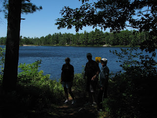
Werner and Kathie showed up later (they had just gotten through the last lock on the Trent) and we went for a hike around a small inland lake.


Nice spot and only got lost once!


We stayed there two nights enjoying the peaceful cove and then headed off toward Parry Sound, home of Bobby Orr, the hockey legend. But first we passed the "world famous" Henry's Fish House on Frying Pan Island. Apparently folks stop here for the 'fantastic' whitefish and pickeral dinners, They even have fly-in tours from Parry Sound on seaplanes to enjoy Henry's. All the loopers we talked to said it was mediocre at best so we took a pass!


After Henry's we took the South Channel up to Parry Sound, past some new construction of another "cottage" on their own island.


Under bridges and one swing bridge before Parry Sound that only opened on the hour - made it there with only seconds to spare!


Spent the night at Parry Sound, Went to the Bobby Orr museum, liquor store (again!) and had dinner out on the town. Whoopee! Off early the next morning through the "hole-in-the-wall", a very narrow channel.


Past Killbear Point and a cleverly disguised cell phone tower - it had us wondering how come there was only one tall tree.


And even more narrow channels - this is the entrance to Canoe Channel which the guide book says is not suitable for vessels more than 40' long - thank heavens we're only 36'!


Out into the channel surrounded by rocks,


And then back into the small vessel channel and the historic lighthouse at Point Au Baril with a small museum. Of course there was no where to anchor and the only dock was about 15' long.


Left the channel to get diesel in Bayfield. Got several hundred liters and then saw the price: $1.69 a liter! Just about had a heart attack! Managed to knock him down to $1.40; still way too much but I can live with it.

Anchored in a cove near there and practiced throwing lures in the water.


Off early the next morning (Werner and Kathie following us) and had a mix of everything - open water around Hangdog Bank, lost the GPS in the rain part of the time (do you remember how to navigate?), through squiggly narrow channels to finally arrive at an anchorage in the Bustard Islands. Beautiful spot and great for exploring in the dinghy. Bustard Islands are off the mouth of the French River.


We even saw a very large water snake curled up basking in the sun (me without the camera of course). There are Massassauga rattlesnakes here so you do tend to tread lightly.


Off early the next morning (sunrise) across 20 miles of open water and then into Beaverstone Bay and Collins inlet. 


Past some 'quaint' cottages on the rocks,


some on a hilltop,


some spifffy, and


some where, unfortunately, an architect got involved.


And one stretch of rocky islands that had three lighthouses!


Collins Inlet has a very narrow entrance and is almost 17 miles long - some of the most protected and pristine water we have seen so far.


And beautiful stone cliffs on either side.


Stopped just short of the end of the inlet to anchor for the night with several other boats ("Sea Venture" and "Just In Time"). Went for a dinghy ride and hikes on the rocks around the anchorage.


Off the next morning after a breakfast of blueberry pancakes (we had picked the blueberries yesterday) and across flat calm waters through Killarney and into the beginning of the North Channel. We had enjoyed some really great anchorages, beautiful calm weather and wonderful scenery. It's no wonder Georgian Bay is such a popular cruising area and "cottage country".