Tuesday, September 29, 2015

The Tenn-Tom Waterway

The Tenn-Tom (the Tennessee-Tombigbee Waterway) is a man-made canal connecting the Tennessee and Tombigbee Rivers. starting at Yellow River, only a few miles past the Pickwick Lock. It is 234 miles long (is over five times longer and has a total lift 3.5 times greater than the Panama Canal). This mammoth undertaking moved more earth than was moved in the construction of the Panama Canal, and is relatively unknown throughout the U.S. to the general public. Construction began in 1972 and was completed in December, 1984 at a cost of nearly $2 billion. The Tenn-Tom ends at Demopolis, where it joins the Tombigbee River at the southern end. From this point it is 217 miles to Mobile, AL.

Our first anchorage was just a few miles down the waterway behind Goat Island, aptly named. The goats are all male, (big long beards, horns and sporting very large genitalia!) that live on the island. The local boaters come by to feed them.


Off the next morning for our trip down the Tenn-Tom, no real current to speak of and the waterway is narrow and straight.


We've never seen this before, herons sitting on the marker buoys - usually they are feeding along the shoreline.


Our first lock down is a whopper: the Whitten Lock drops us 84 feet (that is as tall as an eight story building)! This is the highest lock we have encountered on the entire trip; in fact this is the third largest lift east of the Mississippi. Locking down seems to be much easier than going up - just drive in, pick a floating bollard about half way in the lock, throw a mid-ship line over the bollard and tie it off. We were the only ones in the lock that morning.


We radio the lock tender that we are secure, he closes the gates and whoosh, down we go at an incredible rate, but very smoothly. The bollard floats down as the water recedes and we just hang on.


The lock just dumped 46 million gallons of water into the Tenn-Tom, just for us!

There is a surprising amount of commercial activity along the waterway. This outfit grinds up trees for mulch and then loads the mulch into barges. Big operation.


Arrived mid-afternoon at Midway Marina, topped off the fuel tanks ($2.99 a gallon!) and then took their loaner car into town, Fulton, for some supplies. We also toured the Jamie Whitten Historic Museum (the lock was named after him, one of the longest serving Representatives in the US House, 53 years).

Off the next morning through more locks. At the first one we got swarmed by Mayflies which were hanging on the lock wall in the shade and decided to go for a ride with us. What a mess!


We are trying to make some time on the waterway and, in reality, there are few marinas or places to anchor. We went through five locks that day and dropped over 130'. We stopped early evening at a creek that wound up toward the town of Columbus and found an anchorage past some smaller boats. The name on this one was pretty cute: "Cirrhosis of the River".


At one of the locks there was a museum and this old boat on display. It is the last steam-powered, paddle-wheel driven "snagboat" in existence. For something like 60 years this boat worked the many waterways, cleaning up snags and logs. Unfortunately, there was no dock to tie up to or we have stopped.


And as we are motoring along what do we see on the bank? A telephone booth! Wonder if it works? The locals seem to have a sense of humor!


Made it to a nice anchorage just below the Heflin Lock in an "oxbow" (a sharp curve) that was fed by the dam. Nice quiet spot and the current kept us straight as an arrow. We were later joined by "Latitude Adjustment", a sailboat (without a mast) that is also headed for Mobile. We had first met them at Midway Marina.


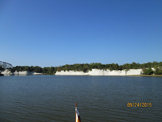
We have had some spectacular sights such as these chalk cliffs which date back to the same time as the White Cliffs of Dover.


And the weather has been almost perfect, cool nights and warm days with just a little wind.


We had been traveling with "Latitude Adjustment" and another fast boat "Good Old Girl" off and on for the past several days and we all ended up at the same marina in Demopolis, the official end of the Tenn-Tom waterway.


We first stopped for some diesel at the fuel dock which services the river tugboats. We took on 62 gallons while the tug opposite us took on 21,000 gallons! Moved over to the marina, Kingfisher, very nice setup. We borrowed their loaner cars and all six of us went out for dinner at one of the local restaurants.

We all left at 7:00 to get through the Demopolis lock together, early morning mist from the dam.


and then "Good Old Girl" took off and left us far behind. We are slightly faster than the sailboat and eventually left them behind as well.

As we go through the locking process it is neat to see the herons and egrets take advantage of the locks. These guys wait until the doors close and then go after the fish that squirt through the gaps in the doors.


We anchored just off the channel in a bight that protected us from the barges, nice peaceful spot except for one barge at 4:30 AM that rolled us back and forth as the wake bounced back and forth between the sides of the channel.


That was one of the longest mileage days we have had in a long time, 91.8 miles and almost 11 hours of motoring. Up at 6:30 and off we go. Past Bobbie's Fish Camp - one of the places some folks think is "must stop" and others think it is a waste of time.


Another long day of motoring down the waterway with perfect weather.


Made 87.6 miles to an anchorage up the Tensaw River, very peaceful. The next morning we started to get into civilization. Coal fired power plants and more barge traffic.


We passed through our last lock and are now at sea level. We have gone through 109 locks on this trip (up & down) and were at our highest point above sea level at Balsam Lake on the Trent-Severn in Ontario, at 841 feet.

Now we are in salt water and welcome to Mobile! It's been a long time since we saw tall buildings, lots of docks with large transport and container ships.


And even naval vessels in dry docks.


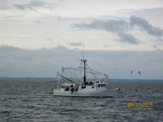
We escape the downtown area and get out into the northern section of Mobile Bay with shrimping boats and, good heavens, waves!


A long 15 miles down the shipping lane and into a small channel into Dog River and the marina. We are tired. It started spitting rain as we went in the small channel and was raining buckets by the time we tied up at the dock. We got 8 inches of rain that night. Needless to say, we couldn't see the eclipse with the stormy weather.

We will spend several nights here because the weather forecast is poor and we need a bit of a break from the long days of motoring.

Monday, September 28, 2015

The Tennessee River

Once we got through the Barkley Lock we only had a few miles to go to Green Turtle Bay Marina. We stopped for fuel and a pump-out and then got our slip. Barely tied up before we met several of our old traveling buddies: Knot Home, Sea Venture and First Snow.

Many of these folks are either waiting for the end of hurricane season, November 1st, for insurance reasons, or are headed for the AGLCA ("looper's" association) rendezvous later in October. So they have no reason to move along while we are anxious to get back to our home in Nova Scotia to close it up before winter.

Werner and Kathie are going to leave their boat her for a week while they drive to Virginia to met their new grand-daughter, Vera Simone. Now that's a classic name. To celebrate their new grandchild, (and to say good-bye as we will continue on) we went to Pattie's Restaurant in 'downtown' Grand Rapids, home of the 2" thick pork chop! Werner and I had to order one of course; I can't believe he ate the whole thing! We had leftovers from mine for two days.


The Cumberland River parallels the Tennessee for many miles and then continues up past Nashville to Celina, TN. The beginnings of both of these rivers are really lakes made when the Tennessee Valley Authority dammed the Tennessee River and built the Barkley Dam in the 1930's. The area between is called (appropriately) the "Land Between the Lakes"; it is the largest inland peninsula in the U.S.

We left the marina late morning the next day, crossed from Barkley Lake into Kentucky Lake (and the Tennessee River) via a canal. Kentucky Lake is one of the largest man-made bodies in the world; it covers 160,000 acres and has 2,380 miles of shoreline and while the southern part looks more like a river, the lake is technically 240 miles long.

We first stopped by a now sunken quarry for lunch and a quick review of the local graffiti.


And then moved on to Sugar Bay for the night.


Up early the next morning after a beautiful sunset and quiet night (except for the coyotes).


As we go up the river we see all kinds of things. This is an abandoned building near a bridge just off the channel. Project anyone? Waterside Grill?


Then on to an anchorage in Birdsong Creek, just off the river in a small creek. We anchored and then took the dingy almost 2 miles up the creek to a marina where we got some ice for drinks - what else? On the way back we met "Marquesa" heading for the marina.

A beautiful dawn and then off we go.


As we go along the river it's obvious they expect some flooding. The houses are either high up on the banks,

or as high as they can get them on stilts!


And then we come across some developer's dream; buy some river-frontage from a farmer and build a row of stilt homes. Ticky-tacky, all in a row. And they want $25k for a small lot!


Found another anchorage behind an island on the river. As we left the next morning we saw several goats huddled along the river. I guess the locals get tired of their goats and drop them off on these islands. Too weird.


Then up to the Pickwick Lake Lock for another lift up to the lake. We had to wait for them to lock down a barge. The lock master told us to get as close as we could and then slide in behind the tow so he could lock us up.

The doors open and here comes the tow, looked like he was scraping the sides of the lock as he came out.


We are now at 417' above sea level - our last lock up. It should be down hill from here! A few miles on down the scenic Pickwick Lake and we turn right at the Yellow River, the official start of the Tenn-Tom Waterway,

The Ohio and Cumberland Rivers

We started up the Ohio River early afternoon past Cairo, IL. The Ohio River is 981 miles long and starts in Pittsburgh, PA, the junction of the Monongahela and Allegheny Rivers. However, we only go about 70 miles upstream on the Ohio and another 30 up the Cumberland plus three locks.


We (there were 7 boats) got escorted by a small tugboat through the Olmstead Lock which is under construction (and has been for years!). It was supposed to be finished in 2014 and was meant to replace two existing locks on the River, lock 53 and 52. The new scheduled completion date is 2020 and in the meantime they are repairing lock 52 which is causing major delays.


The tugboat escorted us through the Olmstead and then took us over the wicket dam instead of through lock 53! At high water they lower the wicket dams (not sure how they do that) rendering the lock meaningless and you can motor directly over the dam. Perfect. Just a few days before that we knew of boats that had to wait several hours or more to transit that lock.

Follow the tug boat!


Then we continued on up the river for another 20 miles and found an anchorage off the main channel; no protection from the tug wakes. The bottom was very rocky and "It's About Time" couldn't get their anchor to hold so they rafted up with us; not our favorite thing to do especially in all that current but it worked fine. Launched the dingy and had "boat drinks" on "Reflection", 47' trawler, (George and Pat). The small Ranger Tug, "I Think I Can" (Randy and Cindy) were rafted with Reflection. Amazing how ten more feet can make such a difference on a boat.


The sides of the channel are parking lots for barges waiting to go through Lock 52. Some may have to wait two days or even more to get through. We talked to one captain and he said this is a very boring part of his job. They nose the barges into the shore and then idle their motors in gear to hold them there. The number of barges waiting to get through was amazing, they seemed to be stacked up everywhere along the river.


An average 8 barge tow (and many of these on the river were much larger, the largest we've seen was 21 barges) can move as much freight as 120 rail cars or 480 tractor trailer trucks. And a barge can move a ton of freight twice as far as a train and 6 times as far as a tractor trailer on the same amount of fuel. These large tug boats are really impressive. Well over 80' long.


We left the next morning to anchor in front of the dam by lock 52 to wait our turn; there were eventually 7 pleasure craft waiting. It was almost painful to watch the large tows get through the lock. We waited almost four and half hours as they managed to get one large barge up the lock in stages (take them apart, then reconnect them) and then waited for one tug down. As Werner put it, "excruciating"!

Finally got that over with and were able to continue on up the river. Most pleasure boats avoid the Tennessee River junction because of the heavy commercial traffic/lock and instead continue up another few miles to the Cumberland River. We anchored in a small cove just before the junction with the Cumberland. We needed a break; took the dinghy for a ride, had showers off the back of the boat, took it easy and watched the bald eagles.


Off the next morning to motor up the Cumberland River to the Barkley Lock and dam. Unfortunately the lock was busy and so we had to wait for more than an hour. The current coming out of the dam was quite strong and we ended up anchoring a bit downstream to wait it out.


Once we got through the lock we were in Barkley Lake and had only a short ride to Green Turtle Bay Marina where we had reservations for several nights. Supposed to be one of "the" places to stop in this area. Next up, the Tennessee River.

Wednesday, September 16, 2015

The Mighty Mississippi

We joined the Mississippi at Grafton, MO and immediately picked up 3-4 miles an hour of current in our direction and more as the Missouri River joins the Mississippi 22 miles downstream. Amazing the difference. We have 218 miles to go on this section until we leave the Mississippi at Cairo, IL. and turn left up the Ohio River.

The terrain changed almost as soon as we approached the Mississippi; we now see bluffs in the distance.


We decided to get a marina at Alton, IL, just a few miles down from the junction. Left the next morning after waiting for fog to lift and headed downriver towards St. Louis. But first through the Mel Price lock, 23' drop, and then into the Chain of Rocks canal which bypasses a section of rapids on the Mississippi. Rapids would not be good. Five mile per hour current is thrilling enough!


Then into the Chain of Rocks Lock, a 27' drop, and then rejoin the Mississippi.


Then into St.Louis with it's massive and amazing arch.


No marinas or docks to stay in at St. Louis. Weird because most towns have something - but St. Louis is all business - very busy barge traffic.


And some whimsical lawn art: a diver going into a pool, only the legs showing.


On to Hoppies Marina - one of the must-stops on the river. Hoppies is located in Kimmswick, MO, the second oldest town in MO, founded in 1859, with fewer than 200 residents. In 2007, almost the entire 7-block commercial district was added to the National Register of Historic Places. The marina itself is run by Fern and "Hoppie" Hopkins who live on site (unfortunately Hoppie was in the hospital for back surgery when we were there). The Hopkins men worked on the river as 'lamplighters' for the shipping beacons for years, long before powered lights were installed. Hoppie may be the last living Mississippi River lamplighter.


Every evening Fern has a get together for all the boats at the dock and gives great information on the river: where to stay, what to watch out for, where to anchor, etc. Of course we neglected to get a picture of her - too busy taking notes!

The next day we rented a car with Werner and Kathie from It's About Time and drove into St. Louis. First up was to buy tickets to tour the arch at the old courthouse with its famous rotunda.


The courthouse was officially opened in 1845 and is a beautiful ornate building. One of the most important cases tried in the American court system began here - the Dred Scott case, where Dred and Harriet Scott (a slave family) initiated a lawsuit for their freedom. Through many trials and appeals the case reached the U.S. Supreme Court where the Scott's lost their case and were not given their freedom, even though slavery was not allowed in MO. The Dred Scott case helped move the country toward the Civil War.

And then a short walk to the arch. The area surrounding the arch is under construction - a new park area is being built.


You go up inside the arch in tiny cars (each holds five people and are are extremely claustrophobic - just ask me!). A four minute ride takes you up 630 feet where you can peer out small windows to take in the view.


The 630' high Arch was designed by Eero Saarinen in 1959 memorializing the role of St. Louis in the westward expansion of the U.S. - the gateway to the West. The Arch, built between 1963 and 1965, is a sandwich made of stainless steel on the outside, carbon steel on the inside, and concrete in the middle. We watched a film of the construction which was just amazing. It is designed to flex up to 18" in high winds - thankfully it was calm that day.

After that excitement we were thirsty so we went to the original Anheuser-Busch factory for a tour, and some free beer!

First a look at their famous Clydesdale horses,


And the wagons in their barn.


The old brew house which is still in operation.


Very impressive building with the working clock tower,


And all the original ironwork railings and stairs.


Back to Kimmswick for a quick tour of the town (forgot to take pictures) and then back to the boats to get ready for another day.

Left the docks at 6:45 for a 42.1 mile trip down the Mississippi to the Kaskaskia River where we could tie up next to the lock/dam for the night.


Off the next morning for another long day (60+ miles) down the ole Mississippi to an anchorage in a channel, Little Diversion Canal. It was quite narrow so we used a stern anchor to hold us in the middle. Other boats anchored opposite each other and then tied their sterns together.


Up at 6:00 for an early start in the fog.


And I mean fog! There is a bridge in front of us here.


It finally cleared up and we had a nice run down the final stretch of the Mississippi,
past the town of Chester, IL.


We are going downstream at over 12 mph and as we make the turn upstream into the Ohio River we are swept sideways and come to a screeching halt! Now we are  doing only 6.5 mph.


And we slowly start up river past the town of Cairo, IL.


We don't go very far on the Ohio (about 90 miles) but we have several locks to go through and several are under construction. We have been warned it may be a slow trip with long waiting times; we shall see.