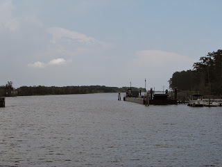
Our traveling companions (Neil and Susan) were right behind us but decided to proceed on. We got an email the next day that they had arrived in Beaufort in a "cloud of salt spray". Nothing we would miss.
Skull Creek Marina had a nice long face dock protected from the NE wind by the other boats so we called them up and tied up with no problem. Rate was reasonable, very nice people and hot showers! This is looking over all the boats towards the marina office.
Hilton Head is one of those prestigious islands with lots of private "plantations" or gated communities.
The marina had free loaner bikes so we had a nice long bike ride on paved biking trails through the very nice homes, golf courses, and country clubs to the beach where we went for a walk. Good to get some exercise. Of course we forgot to take the camera!
Nice quiet evening and off the next morning early for an easy run up the sound. Saw this mega yacht anchored in the sound. It's hard to it make out but in the aft side there is a "garage" where they could keep several boats. Nuts.
Just as you start to go up the Beaufort River you pass Parris Island, where they proudly declare "We Make Marines". I just had to include this for my buddy Bob Starks (once a marine, always a marine).
Perhaps this brings back fond memories for him.
Blew through Beaufort (B'you Fert) or however they say it there. We had originally planned on stopping there for at least one night but after the stop at Skull Creek we decided to make some progress towards our goal.
As you can see the tidal variation here is significant, about 6-7 feet. Buddy's boat is quite a ways in the air at low tide.
It's hard to do this justice but the pier from the house to the dock must be several 100 yards long, just to get to enough water to float a boat.
There were kids jumping off the roof and we didn't quite catch two of them doing multiple somersaults in tandem - pretty good.
This is what they call the Low Country area of South Carolina. Seems to be an apt name.
We made it to an anchorage just off the ICW and south of Elliott's Cut - the narrow entrance into Charleston. Made 90 miles, best day yet.
7:15 departure to get the flood tide through misty Charleston Harbor. On the way past the main marina area we saw what looked a lot the the Bluenose (the famous yacht from Nova Scotia) along with the usual mega yachts.
After we passed through the Harbor and Ft. Sumter, we entered a very narrow and very shallow passage. At one point we had to sneak by a barge that was aground and I think we only had 4' of water (we draw 3.5').
Not sure what happened here but buddy isn't going anywhere soon.
Again we saw really long walkways from the houses out to their docks - I have no idea how they placed all those pilings or what it would cost to do so.
This is a pontoon bridge that floats across the ICW when there is traffic. Don't see too many of those.
This boat passed us and I wish I had gotten a better picture. This is a 1947 "Trumpy" yacht in immaculate condition. Trumpy was famous for building stately motor yachts (wooden) and I'm pretty sure several Presidential yachts were Trumpy's.
Another uneventful day (75.5 miles) and anchored in a great spot behind and island off the ICW with several other boats.
Off early again (7:00) and up the scenic Waccamaw River towards Mrytle Beach.
Lots of nice older homes on the waterway with their own docks.
But then the developers got into and started building homes packed in as tight as they could legally build them. You can almost shake hands from one balcony to the other.
This is also the place where you take a gondola from the main drag over the ICW to the golf course on the other side.
And finally to an rather uncomfortable anchorage on Calabash Creek. We managed to get in a spot where the current and winds caused us to swing around like a top while the boat only a 100 yards away sat as serene as could be. Calabash Creek is on the border between South and North Carolina so as we spun around, the stern would be in North Carolina one moment and then back to South Carolina the next! Enough for one day!
http://share.findmespot.com/shared/faces/viewspots.jsp?glId=09gIadbAR57q4yaL640RZgpYIKfqgur8r
We are using a satellite locator device called SPOT that allows us to track our position and send OK or SOS messages. It only holds the tracked positions for 7 days but you get the idea.


No comments:
Post a Comment